


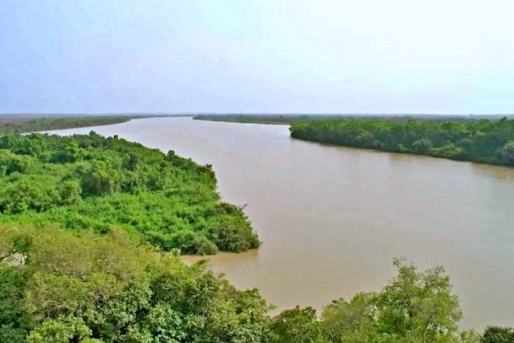
Gambiaj.com – (KEDOUGOU, Senegal) – Water levels along the Gambia River are showing mixed movements, with some monitoring stations recording notable rises as the rainy season progresses, although none of the monitored locations have reached their designated alert threshold.
The latest hydrological bulletin from the Tambacounda/Kédougou Water Resources Brigade, issued on Wednesday, August 26, shows increases at Mako and Gouloumbou, while levels declined at Kédougou, Simenti, Diaguiri, and Niokolokoba.
For The Gambia, where the Gambia River is a major source of water and supports communities, agriculture, fisheries, and other economic activities, the latest readings underline the importance of continued monitoring as water levels fluctuate across the river system.
Significant Rise at Gouloumbou
The most notable daily increase was recorded at Gouloumbou, where the river rose from 5.34 meters on Tuesday to 5.48 meters on Wednesday, an increase of 14 centimeters in 24 hours.
Gouloumbou is a locality in southeastern Senegal, in the Tambacounda region, and is particularly relevant to The Gambia because of its proximity to the country’s eastern border. In a straight line, Gouloumbou is approximately 11 kilometers (6.8 miles) from the nearest point on the Gambian border, near the easternmost tip of The Gambia beyond Fatoto.
This close geographical proximity means developments in the river around Gouloumbou are of particular interest when assessing hydrological conditions in the wider Gambia River basin and their potential implications downstream in The Gambia.
Although the rise at Gouloumbou is significant, the level remains 6.52 meters below the station’s alert threshold of 12 meters.
At Mako, the river also recorded a rise, moving from 3.65 meters to 3.68 meters, an increase of three centimeters. The level remains 2.32 meters below the alert threshold of six meters.
Kédougou Level Falls but Remains Above Last Year
In Kédougou, the river level fell by four centimeters, from 4.22 meters to 4.18 meters.
Despite the daily decline, the level remains significantly higher than it was on the same date last year. On August 26, 2025, the river stood at 3.66 meters, meaning the current level is 52 centimeters higher year-on-year.
The station’s alert threshold is seven meters, leaving a margin of 2.82 meters.
Sharp Declines at Other Stations
The largest 24-hour decline was recorded at Diaguiri, where the level dropped from 2.38 meters to 1.85 meters, a fall of 53 centimeters.
The station has also recorded a substantial year-on-year decline. On August 26, 2025, the river stood at 3.58 meters, making the current level 1.73 meters lower.
Niokolokoba recorded a smaller daily decline of two centimeters, from 1.41 meters to 1.39 meters. However, the year-on-year difference is much more pronounced. The level was 6.89 meters at the same time last year, representing a decrease of 5.50 meters.
At Simenti, the river fell by 17 centimeters, from 5.62 meters to 5.45 meters. The level remains 7.55 meters below the station’s 13-meter alert threshold.
Vigilance Remains Necessary
The bulletin presents a contrasting picture of the Gambia River system, with water levels rising at some stations while falling sharply at others.
None of the monitored stations has exceeded its alert level, and the overall situation remains under control. However, the fluctuations highlight the need for continued hydrological surveillance, particularly during the rainy season when river levels can change rapidly.
For communities downstream in The Gambia, regular monitoring remains important. A rapid rise in the river could have implications for settlements, farmland, and other areas located along its banks.
The authorities therefore continue to rely on daily readings from hydrometric stations to detect significant changes early and provide warnings where necessary.











Leave a Reply